
South east Wales has a number of recognised long distance walking routes. These vary from easy-going good surfaces to rough mountain hikes. Some suggestions follow. Further information may be obtained from the Long distance Walkers Association, GPS Cycle and Walking Routes, The Walking Englishman, Mapometer, and Wikipedia.
 The Taff Trail 60 miles: Cardiff - Merthyr - Brecon.
The Taff Trail is a multi-purpose route between the Cardiff waterfront at Cardiff Bay in the South and the Market Town of Brecon in the North. 55 miles (88km) in length, it passes close to Pontypridd and Merthyr Tydfil and through a wide variety of urban and suburban landscapes of those towns and the open moorland of the Brecon Beacons.
To the south of Merthyr the Trail is 9 miles (13km) and follows the eastern flank of the historic Taff Valley affording views over Merthyr Tydfil, once the "Iron Capital of the World". Further south the Trail extends to Cardiff, passing through the beautiful woodlands of Fforest Fawr and the remarkable fairytale folly of Castell coch. The Trail links the Rhymney Valley Ridgeway at Llanfabon to the Coed Morgannwg Way at Gethin Wodland park.
North of Merthyr the Taff Trail consists of a 36 mile (58km) circular walk between Merthyr Tydfil and Brecon. This section travels through the heart of the Brecon Beacons national park giving dramatic views of the beacons themselves. Other attractions include the Forestry Commission's Visitor Centre at Garwnant, the Monmouthshire and Brecon Canal and the impressive Pontsarn viaduct. See www.tafftrail.org.uk
 The Rhymney Valley Ridgeway Walk 27 miles: Caerphilly circular
The Rhymney Valley Ridgeway Walk follows a 27 mile (43km) route around the Caerphilly Basin linking the three main ridges of Mynydd-y-Grug, Thornhill and Eglwysilan.
The whole route can be tackled in one, or in shorter sections, starting from a number of convenient venues at Machen, Hengoed and Caerphilly.
A pleasant mixture of scenery will be encountered throughout the walk, as the route takes you up on to the open hill top commons which rise to 984 feet (300m) at Mynydd Machen through a mixture of lowland farmland. There are splendid panoramic views of the region to be experienced, on clear days you can see as far as the Brecon Beacons in the north to the Bristol Channel and Somerset in the south.

Glamorgan Ridgeway: Ffordd-y-Bryniau 21 miles: Mynydd y Gaer - Caerphilly Mountain
This 21 mile (34km) Ridgeway Walk crosses what used to be the Borough of Taff Ely from Mynydd-y-Gaer to Caerphilly common in the east. It links to the Rhymney Valley Ridgeway in the east, and continues as the Ogwr Ridgeway to the west.
Most of the walk is on open hilltops, but it drops through the forestry to cross the Ely Valley and rise again to the cobbled streets of the mediaeval hill town of Llantrisant. Continuing eastwards it passes Caerau iron age hill fort and the valley of the Nant Myddlyn before climbing to 1000 ft (307m) at Garth Hill. The Taff river is then crossed on a footbridge and the path climbs again to finish at Caerphilly Common.

Glamorgan Ridgeway: The Ogwr Ridgeway Walk 13 miles: Margam Park - Mynydd y Gaer
The Ogwr Ridgeway Walk is an attractive 13 mile (21km) walk linking to the Coed Morgannwg Way in the west, and continuing as the Ffordd-y-Bryniau (Taff Ely Ridgeway) walk in the east.
It can be walked in a day or in shorter lengths from Bryngarw Country park or one of the two car parks provided along the route.
Superb panoramas of the Valleys and the Vale of Glamorgan can be obtained throughout the walk and on clear days views of the Devon and Somerset hills can be enjoyed.
Fine wooded landscapes can be seen near Coytrahen and Blackmill. There is a wide variety of historical and archaeological interest along the route including the bronze Age burial mounds on Mynydd-y-Gaer, and the old railway viaduct at Blackmill dating back to 1876.
 Sirhowy Valley Walk 26 miles: Newport - Tredegar
The Sirhowy Valley Walk runs from Newport in the south to Tredegar in the north. The northern end is at the memorial to Aneurin Bevin, architect of the National Health Service, born in Tredegar. The southern end is at the 17th century mansion of Tredegar House, the home of the Morgan family, including Sir Charles Morgan, father in law of Samuel Homfray.
In between are 26 challenging miles, ranging from the built up fringes of Newport to the mountain ridges of Mynydd Machen and Mynydd Manmoel. There are many reminders of the area's indstrial past. The route includes the line of Hall's tramroad (built by Benjamin Hall, who gave his name to 'Big Ben' at Westminster) as well as the Sirhowy and Penllwyn tramroads. It passes through the Sirhowy Valley Country Park, and the Fourteen Lock Canal Centre on the old Monmouthshire and Brecon Canal.
 Penrhys Pilgrimage Walk 21 miles: Llandaff to Penrhys
Penrhys in the Rhondda has been a focal point for pilgrimage over many centuries. Launched in 2020, you can now walk the Penrhys Pilgrimage Way from Llandaff Cathedral in Cardiff and discover a route rich in history as you travel through the ever-changing landscapes of South Wales.
The route follows public rights of way for 21 miles from Llandaff Cathedral in Cardiff to Penrhys in the Rhondda. It is divided into six parts and can be accessed by public transport at several points. It can be walked in sections or, with an overnight stop in Llantrisant, over two days. The route passes through or near many places of interest – and don’t forget to print a passport and collect all eleven specially-designed stamps along the way! See www.penrhyspilgrimageway.wales
 Raven Walk 12 miles: circular from Cwmcarn
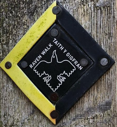
The Raven walk follows footpaths, bridleways and cycleways with only short sections on road or lanes. The paths are mainly dry in summer but can get boggy in winter and after wet weather. This circular route has some challenging climbs but with some truly tremendous views as the reward. The walk starts at the Cwmcarn Visitor Centre and heads to Mynydd Islwyn, Ynys Hywel and Glenside before returning to Cwmcarn. The route includes views of the Sirhowy and Ebbw rivers, the Severn Estuary in the south and the Brecon Beacons in the north. You will also visit Nant-y-draenog reservoir on the way. The path is waymarked with the distinctive black and white Raven walk logo.
Valeways Millennium Heritage Trail 60 miles: circular - Barry, St Brides Major and Cowbridge
"A leisurely walk through 6000 years of beauty, culture and history in the picturesque Vale of Glamorgan"
Recently created by the Valeways organisation this route aims to include all the best spots in the Vale of Glamorgan. The trail is split into 16 easy to follow routes, each of which can be walked within a few hours. The surroundings are diverse, often spectacular and steeped in history. The route takes in too many scenic villages to count, with quaint cottages, grand mansions and castles, old churches, a dovecote etc. Bridges varying from an ancient clapper bridge to a Victorian viaduct, the collection of dark age celtic crosses at Llantwit Major, a lighthouse, two stone age burial chambers, a ruined windmill - the list goes on. Best of all is the rolling farmland and coastal scenery. See valeways.org.uk/.
 The Coed Morgannwg Way 36 miles: Margam park - Aberdare - Merthyr
The Coed Morgannwg Way is a dramatic walk of 36 miles (58km) almost all of which traverses the hills of the Forestry Commission's Morgannwg Forest and Afan Argoed Forest park.
It follows ancient trackways of Celtic origin and passes by a number of Bronze and Iron Age settlements. Along the route are several good view points with views of the Brecon Beacons and Bristol Channel. The highest of these is near Craig-y-Llyn, which is 1968 feet (600m) above sea level.
The whole route can be walked in about 16 hours, starting from either Gethin Woodland Park in the north (where it is linked with the Taff Trail) or Margam Country Park in the south where it is linked to the Ogwr Ridgeway Walk. Shorter sections can also be walked from Afan Argoed or Dare Valley Country parks or from one of the Forestry Commission car parks along the route.
Usk Valley Walk 25 miles: Caerleon (Newport) - Abergavenny
 The Usk Valley Walk closely follows the river Usk, from the Roman town of Caerleon to Brecon, in the heart of the Brecon Beacons National Park. A relatively flat walk, leading through fields and woods, down country lanes, past farms, hamlets and villages. The original walk, from the Ship Inn, Caerleon to Usk Bridge, Abergavenny is just over 25 miles. An extension, mainly following the Brecon canal completes the route from Abergavenny to Brecon.
In addition to the unspoilt river scenery and views of the mountains, sites to visit along the way include: the Roman amphitheatre and remains at Caerleon, the derelict Llancayo windmill, Clytha house and castle, Coed-y-Bwynydd Iron Age hill fort, Abergavenny Castle, Llanelly church, the towns of Llangattock and Crickhowell and the aqueduct and lock near Brecon. There are museums at Abergavenny, Brecon, Caerleon, Newport and Usk and railway stations at Newport and Abergavenny.
 The Cambrian Way 265 miles: Cardiff - Conwy
A tough high level coast to coast walk through wildest Wales, described as 'The Mountain Conoisseur's Walk'. This 265 mile route covers the whole of Wales, starting in Cardiff. Following the first proposals for the Cambrian Way in 1968, the Countryside Commision showed great interest but bowed to opposition in 1982 and abandoned the project. However, this unofficial route follows existing rights of way and other public spaces, and is recommended as a fine three week walk through scenically superb and largely unfrequented mountain country. It has recently been waymarked with assistance from Ramblers Cymru.
The full mile route is really only suitable for experienced walkers, having double the ascent of the Pennine Way. However, the stretch through South East Wales is not difficult. The first part follows the Taff Trail out of Cardiff, and then the Rhymney Valley Ridgeway to Machen. See www.cambrianway.org.uk/.
 The Wales Coast Path
Cardiff lies on the coast, and the Wales Coast Path can be followed in both directions. To the west it follows the Glamorgan Heritage Coast with its dramatic cliffs and rocky coastline. The area was one of the first two coastlines in Britain to be jointly designated as 'Heritage Coast' by the Countryside Commission and local authorities in 1972. When the weather is bad, the coast must be given proper respect as many of its aspects are dangerous. At high tide most of its beaches are tide traps and can be fatal, whilst the edges of the shattered cliffs are constantly falling, making them equally dangerous to people above or below them. When viewing the peace and grandeur of this exceptional area, remember that it is the constant movement and extremes that shape it.
To the east it follows the sea wall along the wetlands of the Wentloog Levels. The Severn Estuary narrows eastward, and tides vary between lapping at the sea wall, to expanses of mud with flocks of sea birds. See www.walescoastpath.gov.uk/.